No Warning, Advisory or Watch is in effect for Puerto Rico and the Virgin Islands.

No Warning, Advisory or Watch is in effect for Puerto Rico and the Virgin Islands.
On Monday March 12th, 2007, we visited an area in the Carite Neighborhood in Guayama, Puerto Rico. The purpose of the visit was to investigate and make observations due to a series of calls from the residents of an area nearby where you could hear sounds near the mountains, and had damages in structures. These damages were caused by five minor felt earthquakes, felt mostly by residents of that area, analysed by PRSN personnel. Two earthquakes were felt on March 7th, one on March 8th and two on March 11th, 2007. 20 additional non felt earthquakes were detected by the PRSN in the area near the Carite Neighborhood since March 1st, 2007. A geologist from the PRSN was sent to the area, along with a representative of the Department of Environment & Natural Resources of Puerto Rico (DRNA), Geologist Ruth Vélez. Also present were Mr. Orlando Collazo and other personnel from the Offices for Emergency Managment of Guayama and Mr. Paul Fourquett of the Zone 7 of the DRNA.
The area around the Carite neighborhood is localized inside the Patillas Quadrangle as defined by the United States Geological Survey (USGS). Until this moment, there isn't a geological map available for this Quadrangle. The inspection realized by geologists from the PRSN and DRNA found that most of the volcanic sandstone and siltstone altered. There was evidence of hydrothermal alteration as well as deep saprolithic terrain with very little stability. Plutonic rocks were also observed. In the short trip we took around the area, we did not find the presence of faults or terrain cracks that could be associated with the registered earthquakes. However, these observations are preliminary and due to the intensity of the fractured rocks (Figure 1) it should not be discarded. A satelite image obtained of the area through Google Earth shows some valleys in the NE and SW area (Figure 2)
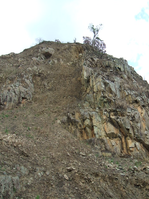
Figure 1. Volcanic rock basset in the 9.2 Kilometer of the State Road Num. 179 in Guayama. Notice the great number of rockfalls.
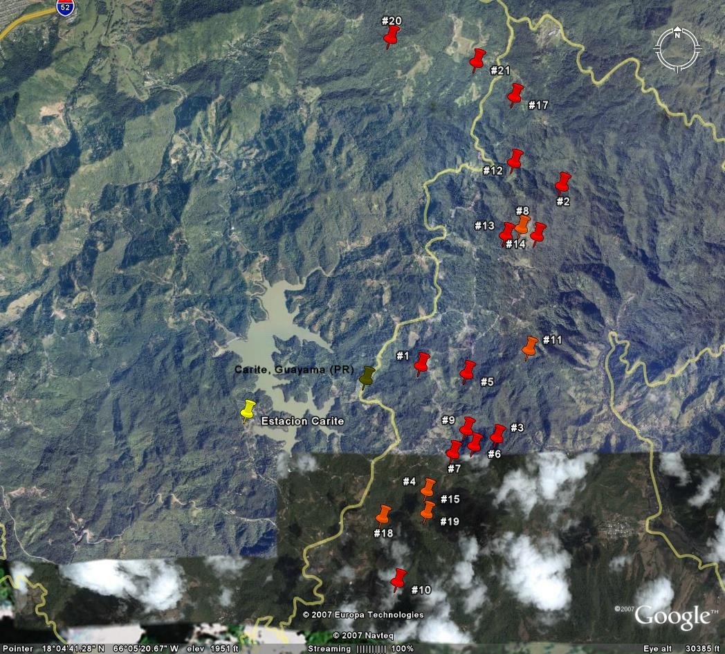
Figure 2. Google Earth Satellite image of Carite Lake and the epicenter of some of the earthquakes analysed by PRSN personnel.
Some residents notified the Office of Emergency Management of sounds in the rocks, fearing they were related to the recent seismic activity. A trip around the area by PRSN and DRNA representatives was made. This specific area is located in the State Road Num 179, Kilometer 6.9. Cracks or Landslides that could be associated with the sound could not be found. We could not hear the sound reported either. According to Mr. Gerardo Díaz, resident of the area and employee of the Puerto Rico Aqueduct and Sewer Authority (AAA), the water service of the area is interrupted frequently. When this service is restored, the large amount of pressure caused by this can be heard and felt if the person is nearby. During our visit on March 12th, we observed various pits made by the AAA were they fixed a 6 inch tube (Figure 3). These were made between March 8 and March 9, 2007. Although more concrete evidence is needed to reach a conclusion, it is possible these sounds might be related to the pressure of this water system.
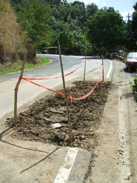
Figure 3. Excavation realized by AAA on the 6.9 Kilometer of the State Road Num. 179 in Guayama.
In the recreative area near the Carite Lake there is a residence where according to OMME personnel, the owner reported damages to the building (cracks). According to the report these cracks were caused by the seismic activity during the days between the 7th and 9th of March, 2007. Since the residents of the house were not available during our investigation, we could not enter the building and verify the alleged damage. However we went around the area and notice a great part of the terrain around the area was very unstable. We observed numerous landslides (Figure 4). In fact, we saw damages in the pool area due to a landslide nearby (Figure 5). Even with these observations, we cannot precise whether the damages of the residence were due to the seismic activity. A more precise geotectonic study is necessary to get a more precise conclusion.
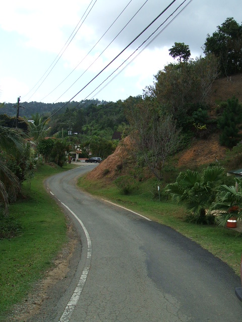
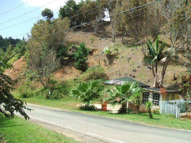
Figure 5. Recreational area with structural damage in the pool area wall (Left) Damage is caused by a landslide beside the wall (Right)
On Tuesday March 13th, 2007, personnel from the PRSN installed a station with an accelerometer in the Carite Lake zone with the purpose of monitoring with more precision the seismic activity of the area. Since redacting this report, no more felt earthquakes or damages have been reported in this area.
Field Report (in Spanish) preparaded by:
David N. Cuevas Miranda, M.S.
Geologist and Data Analyst Graduate Student
Puerto Rico Seismic Network
March 15th, 2007