No Warning, Advisory or Watch is in effect for Puerto Rico and the Virgin Islands.

No Warning, Advisory or Watch is in effect for Puerto Rico and the Virgin Islands.
A critical part to mitigating earthquake hazards is to understand how the ground reacts to earthquake shaking. In collaboration with the PRSMP and UPRM Civil Engineering, researchers at PRSN perform studies on the seismic side of ground motions including development of Ground Motion Prediction Equations, seismic amplification and site response studies, and producing Shakemaps for felt seismic events.
Research is a critical component to operating and continually improving network operations. Researchers, Geophysical Data Analysts, Seismic Technicians and IT all collaborate to not only keep the geophysical network running, but also to improve operations.
Projects in network operations include:
Researchers at the PRSN not only are often called upon as a scientific export for local and state governments and emergency managment agencies, but also serve on a larger scale. Researchers at the PRSN often serve as part of regional and global tsunami and earthquake experts. This includes playing a role in the Advanced National Seismic System (ANSS), the NTHMP (National Tsunami Hazard Mitigation Program), the ICG Caribe-WES and on the IOC TOWS Task Team for Tsunami watch operations
Key to understanding the risks and hazards related to earthquakes in our region is gathering and interpreting geophysical data that reveals the structure and activity of faults in and around the islands, movement of tectonic plates, and critically the structure of the subduction zone to the North of Puerto Rico.
Researchers at the PRSN use a variety of data such as GNSS (Global Navigation Satellite System) as well as analysis techniques such as tomography and receiver functions to unravel the complexities of the North Eastern Caribbean.
Researchers at PRSN perform studies on the local tsunami hazard in the region. This includes managing the PR component of the National Tsunami Hazard Mitigation Production including the TsunamiReady© program. Researchers and technical staff also support the installation and maintenance of sea level stations in the island, which are vital to detecting and recording sea level events like tsunamis. Tsunami models are also produced by researchers on the network. These models are vital to updating and improving the tsunami maps in the region.
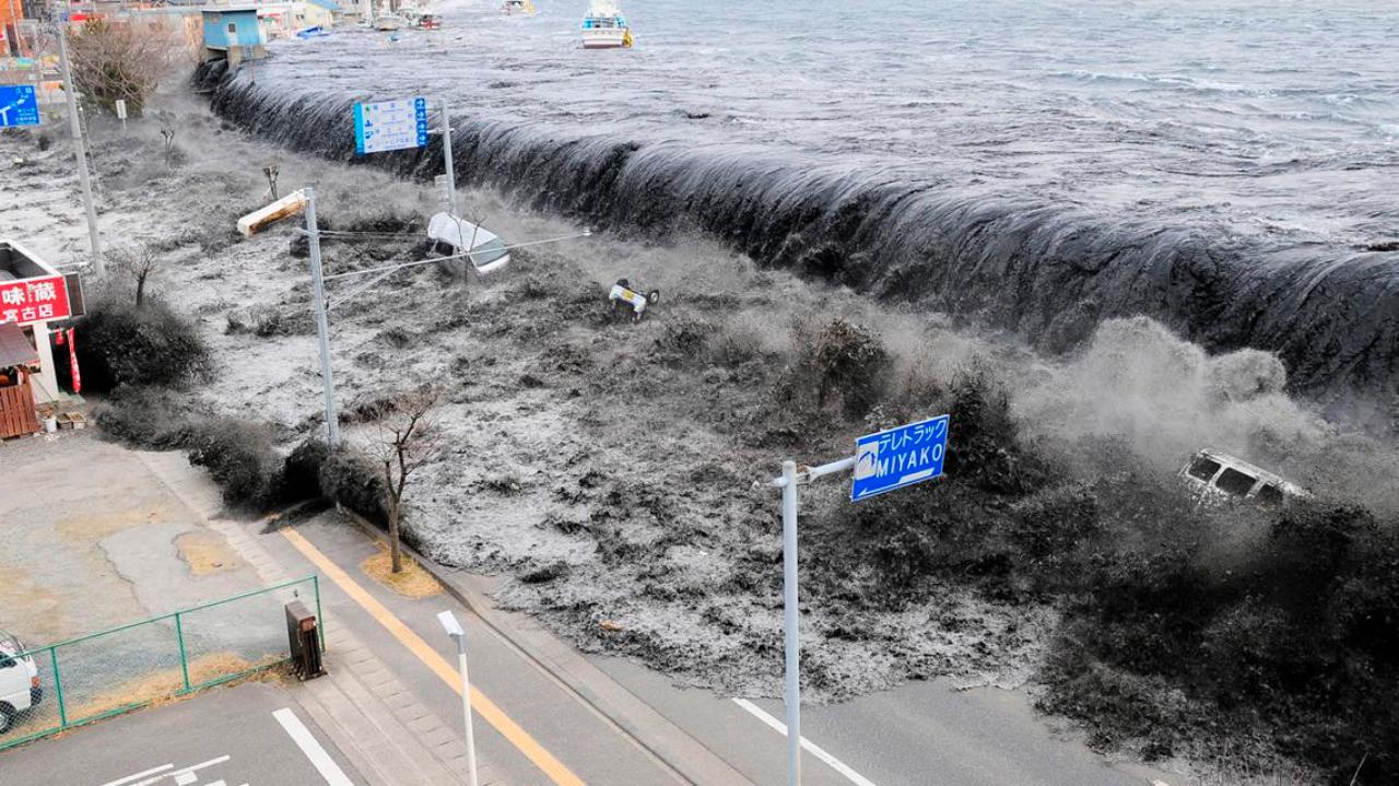 2011 Japan Tsunami
| Name | Operational Project | |
|---|---|---|
| Gisela Báez Sánchez | - | gbaez@prsnmail.uprm.edu |
| Benjamín Colón Rodríguez | - | bcolon@prsnmail.uprm.edu |
| María del C. Torres Vega, M.Sc. | - | mtorres@prsnmail.uprm.edu |
| Javier Charón Ramírez, M.E. | - | jcharon@prsnmail.uprm.edu |
| José F. Martínez Colón, M. Sc. | - | jmartinez@prsnmail.uprm.edu |
| José M. Rivera Torres, M. Sc. | - | jrivera@prsnmail.uprm.edu |
| Josean Barbosa Toro, M. Sc. | - | jbarbosa@prsnmail.uprm.edu |
| Viridis Miranda Berrocales | - | vmiranda@prsnmail.uprm.edu |
| Yanira Santiago Pérez | - | ysantiago@prsnmail.uprm.edu |
| Margarita Solares Colón, M. Sc. | - | msolares@prsnmail.uprm.edu |