
This information is Issued for Puerto Rico and the Virgin Islands.For more information visit your corresponding Seismological Institution or theTsunami Warning Centers
| Event Details | |
|---|---|
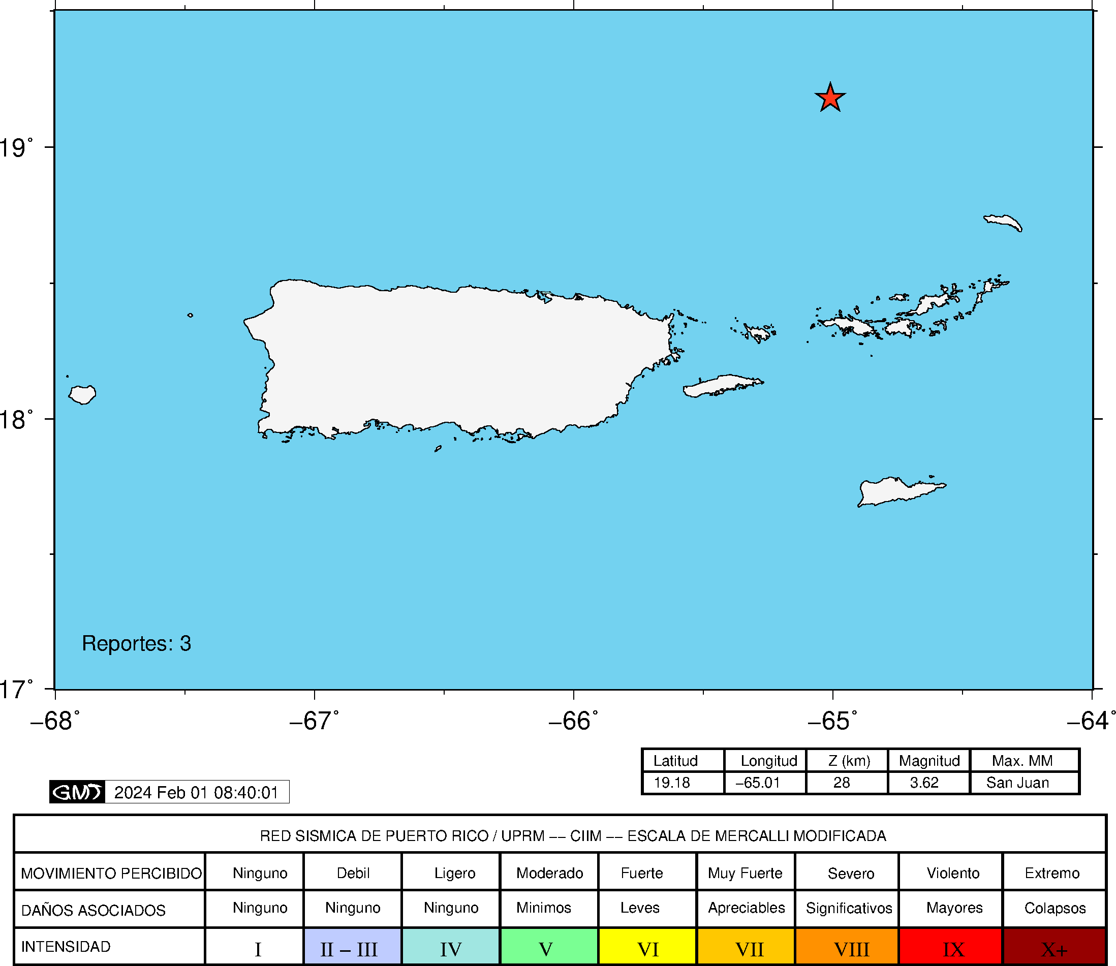
| Estimated Maximum Intensity: | II in San Juan, PR |
| Date: |
January 31, 2024 13:36:15 UTC January 31, 2024 09:36:15 Hora Local |
| Region: | Sombrero Seismic Zone |
| Distances: |
87.58 Km West-Northwest of Anegada,BVI 92.03 Km North of Charlotte Amalie, St. Thomas,USVI 144.43 Km Northeast of San Juan,PR |
| Magnitude: | 3.62 Md |
| Location: | Latitude: 19.1755 Longitude: -65.0081 |
| Depth: | 28 Km |
| Tsunami Warning Level: | No Warning, Advisory or Watch is in effect for Puerto Rico and the Virgin Islands |
| Issued Date & Time | 2024-01-31 12:35:19 |
| ID: | 20240131133610 |
Epicentral Map
| BULLETIN 2 Seismic Event/Tsunami |
|
|---|---|
| DATE: | January 31, 2024 |
| LOCAL TIME: | 09:36:15 |
| LATITUDE: | 19.1755 N |
| LONGITUDE: | 65.0081 W |
| LOCATION: |
87.6 Km West-Northwest of Anegada,BVI
144.4 Km Northeast of San Juan,PR |
| DEPTH: | 28 Km |
| MAGNITUDE: | 3.62 Md |
| ESTIMATED MAXIMUM INTENSITY: | II in San Juan, PR |
| TSUNAMI ALERT LEVEL: | No Warning, Advisory or Watch is in effect for Puerto Rico and the Virgin Islands |
| DATE & ISSUED TIME | 2024-01-31 12:35:28 |
|
The Puerto Rico Seismic Network (PRSN) received information that this
minor earthquake was reported as
felt in San Juan with a maximum
intensity of II (Modified Mercalli Scale, MM).
At the moment of generating this bulletin no damages has been reported and are not expected to occur Based on magnitude, location and historic records the earthquake was not sufficient to generate a destructive tsunami to Puerto Rico and Virgin Islands. |
|

|
|
Technical Information
YEAR MO DA  --ORIGIN--  --LAT N-  --LON W--  DEPTH   RMS   ERH   ERZ  XMAG  FMAG  PMAG  INT
2024-01-31  1336 15.75  19 10.53   65  0.49  28.05  0.34  2.15 20.99        3.62  3.62D
                                                                                         SOURCE
NSTA NPHS  DMIN MODEL GAP ITR NFM NWR NWS NVR REMRKS-AVH  N.XMG-XMMAD-T   N.FMG-FMMAD-T  L F X
  21   21  91.3  PR1  289  12  10  20  11  21     Q- PP0   0.00  0.00      6.00  0.12 D

XMAG2-N.XMG2-XMMAD-T-S  FMAG2-N.FMG2-FMMAD-T-S  PREF.MAG-N.PMAG-PRMAD-T
                         3.62   6.00  0.12 Z        3.62   6.00  0.12 D

REGION= Sombrero Seismic Zone

STA NET COM CR DIST AZM  AN P/S WT   SEC (TOBS -TCAL -DLY  =RES)  WT   SR  INFO  CAL DUR-W-FMAG-T -AMP-U-PER-W-XMAG-T
STVI PR HHZ  A 91.3 176  97 EP+ 1  28.20 12.45 13.69 0.00 -1.24* 0.00     0.000 0.55  88   3.55 Z
STVI PR HH2  A 91.3 176  97 ES  1  40.10 24.35 24.37 0.00 -0.02  1.00S    0.754
FAPR PR HHZ  A126.3 213  94 EP+ 1  33.54 17.79 18.10 0.00 -0.31  1.00     0.113 0.55  70   3.38 Z
FAPR PR HH1  A126.3 213  94 ES  1  47.91 32.16 32.22 0.00 -0.06  1.00S    0.173
HUMP PR HHZ  A144.8 218  93 EP+ 1  35.75 20.00 20.43 0.00 -0.43  1.00     0.092 0.55  91   3.64 Z
HUMP PR HH1  A144.8 218  93 ES  1  51.92 36.17 36.37 0.00 -0.20  1.00S    0.135
GCPR PR HH1  A148.5 230  93 ES  1  52.56 36.81 37.22 0.00 -0.41  1.00S    0.174
CDVI PR HHZ  A159.6 170  93 EP+ 1  38.34 22.59 22.31 0.00  0.28  1.00     0.304 0.55  85   3.59 Z
CDVI PR HH1  A159.6 170  93 ES  1  55.52 39.77 39.71 0.00  0.06  1.00S    0.711
ASPR PR HHZ  A181.3 226  93 EP- 1  40.52 24.77 25.05 0.00 -0.28  1.00     0.095
ASPR PR HH1  A181.3 226  93 ES  1  60.28 44.53 44.59 0.00 -0.06  1.00S    0.132
CELP PR HHZ  A205.8 234  92 EP- 1  43.36 27.61 28.14 0.00 -0.53* 1.00     0.119 0.55 100   3.79 Z
CELP PR HH1  A205.8 234  92 ES  1  66.01 50.26 50.09 0.00  0.17  1.00S    0.116
ICMP PR HHZ  A214.6 229  92 EP- 1  45.69 29.94 29.27 0.00  0.67* 1.00     0.103
ICMP PR HH1  A214.6 229  92 ES  1  67.93 52.18 52.10 0.00  0.08  1.00S    0.165
GBPR PR HHZ  A238.1 237  92 EP- 1  48.06 32.31 32.24 0.00  0.07  1.00     0.129
GBPR PR HH1  A238.1 237  92 ES  1  72.66 56.91 57.39 0.00 -0.48  1.00S    0.127
MLPR PR HHZ  A253.0 239  92 EP- 1  50.16 34.41 34.13 0.00  0.28  1.00     0.139
MLPR PR HH1  A253.0 239  92 ES  1  77.12 61.37 60.75 0.00  0.62* 1.00S    0.129
CRPR PR HHZ  A256.8 241  92 EP- 1  50.21 34.46 34.61 0.00 -0.15  1.00     0.151 0.55 102   3.86 Z
CRPR PR HH1  A256.8 241  92 ES  1  77.78 62.03 61.61 0.00  0.42  1.00S    0.129
Event Maps
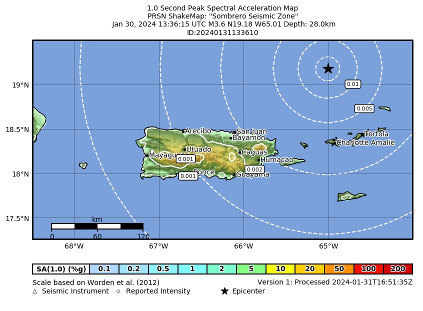 Spectral Acceleration |
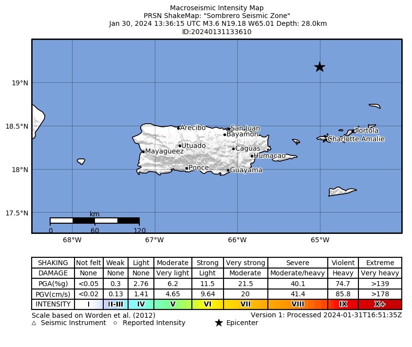 Intensity Map |
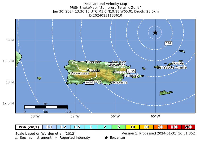 Peak Ground Velocity |
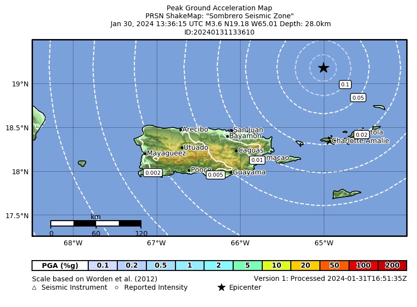 Peak Ground Acceleration |
 DYFI Map |
Google Map for this Event |