
This information is Issued for Puerto Rico and the Virgin Islands.For more information visit your corresponding Seismological Institution or theTsunami Warning Centers
| Event Details | |
|---|---|
| Estimated Maximum Intensity: | I |
| Date: |
January 29, 2026 07:30:40 UTC January 29, 2026 03:30:40 Hora Local |
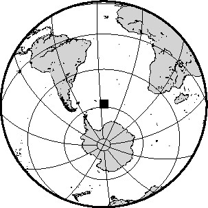
| Region: | SOUTH SANDWICH ISLANDS REGION |
| Distances: |
4372.57 Km East of Coral Bay, St. John,USVI 9137.19 Km Southeast of Montserrat,UK 9491.01 Km Southeast of Ponce,PR |
| Magnitude: | 6.00 mww |
| Location: | Latitude: -57.814 Longitude: -25.565 |
| Depth: | 74.7 Km |
| Tsunami Warning Level: | No Warning, Advisory or Watch is in effect for Puerto Rico and the Virgin Islands |
| Issued Date & Time | 2026-01-29 03:59:07 |
| ID: | 20260129073040 |
Epicentral Map
| BULLETIN 1 Seismic Event/Tsunami |
|
|---|---|
| DATE: | January 29, 2026 |
| LOCAL TIME: | 03:30:40 |
| LATITUDE: | 57.814 S |
| LONGITUDE: | 25.565 W |
| LOCATION: |
4372.6 Km East of Coral Bay, St. John,USVI
9491 Km Southeast of Ponce,PR |
| DEPTH: | 74.7 Km |
| MAGNITUDE: | 6.00 mww |
| ESTIMATED MAXIMUM INTENSITY: | I |
| TSUNAMI ALERT LEVEL: | No Warning, Advisory or Watch is in effect for Puerto Rico and the Virgin Islands |
| DATE & ISSUED TIME | 2026-01-29 03:59:14 |
| Based on magnitude, location and historic records the earthquake was not sufficient to generate a destructive tsunami to Puerto Rico and Virgin Islands. | |
|
|
Technical Information
There is no technical information available for this event.