
This information is Issued for Puerto Rico and the Virgin Islands.For more information visit your corresponding Seismological Institution or theTsunami Warning Centers
| Event Details | |
|---|---|
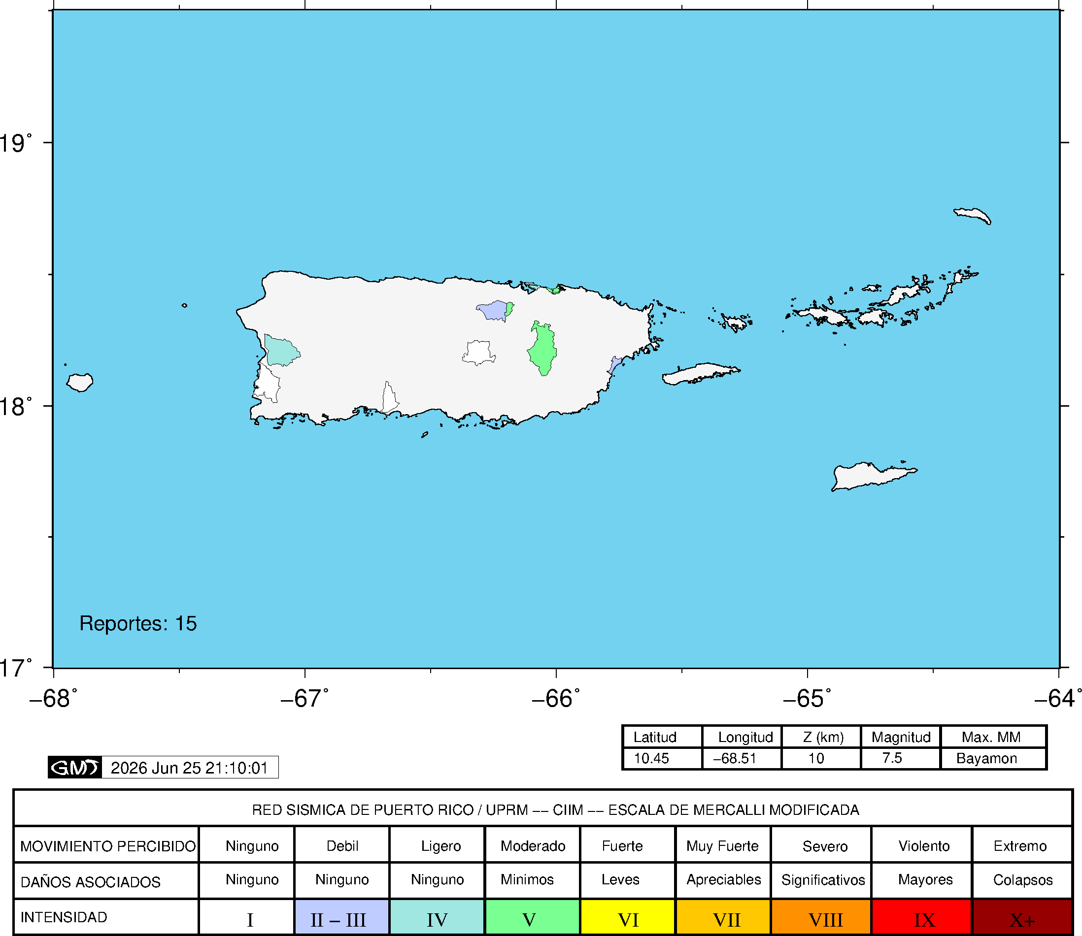
| Estimated Maximum Intensity: | III in Mayagüez, PR |
| Date: |
June 24, 2026 22:05:12 UTC June 24, 2026 18:05:12 Hora Local |
| Region: | NEAR COAST OF VENEZUELA |
| Distances: |
842.72 Km South of Mona Island,PR 847.5 Km South-Southeast of Lajas,PR 863.95 Km South-Southeast of Ponce,PR |
| Magnitude: | 7.5 Mww |
| Location: | Latitude: 10.453 Longitude: -68.514 |
| Depth: | 10 Km |
| Tsunami Warning Level: | A tsunami CANCELLATION messages was issued for Puerto Rico and the Virgin Islands |
| Issued Date & Time | 2026-06-24 21:43:32 |
| ID: | 20260624220435 |
Epicentral Map
| BULLETIN 3 Seismic Event/Tsunami |
|
|---|---|
| DATE: | June 24, 2026 |
| LOCAL TIME: | 18:05:12 |
| LATITUDE: | 10.453 N |
| LONGITUDE: | 68.514 W |
| LOCATION: |
842.7 Km South of Mona Island,PR
863.9 Km South-Southeast of Ponce,PR |
| DEPTH: | 10 Km |
| MAGNITUDE: | 7.5 Mww |
| ESTIMATED MAXIMUM INTENSITY: | III in Mayagüez, PR |
| TSUNAMI ALERT LEVEL: | A tsunami CANCELLATION messages was issued for Puerto Rico and the Virgin Islands |
| DATE & ISSUED TIME | 2026-06-24 19:15:00 |
|
The Puerto Rico Seismic Network (PRSN) received information that this
major earthquake was reported as
felt in widely throughout Puerto Rico with a maximum
intensity of III (Modified Mercalli Scale, MM).
At the moment of generating this bulletin the event has not been reported as felt Tsunami waves have ceased, stay alert for official information. |
|

|
|
Technical Information
There is no technical information available for this event.
Event Maps
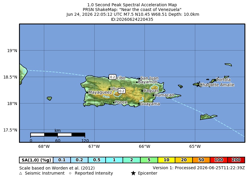 Spectral Acceleration |
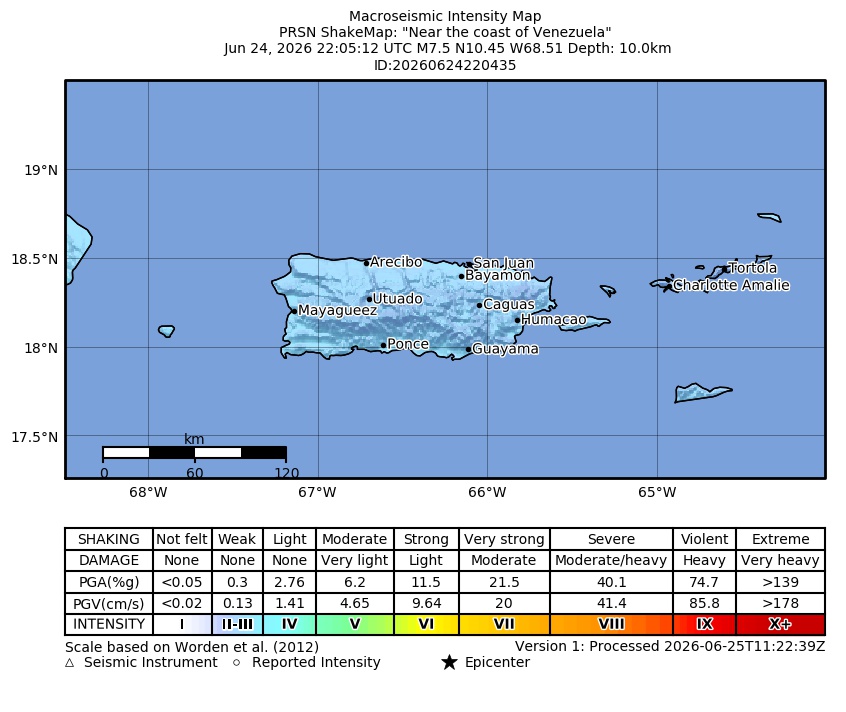 Intensity Map |
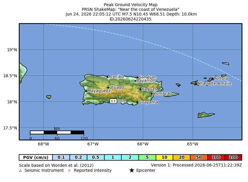 Peak Ground Velocity |
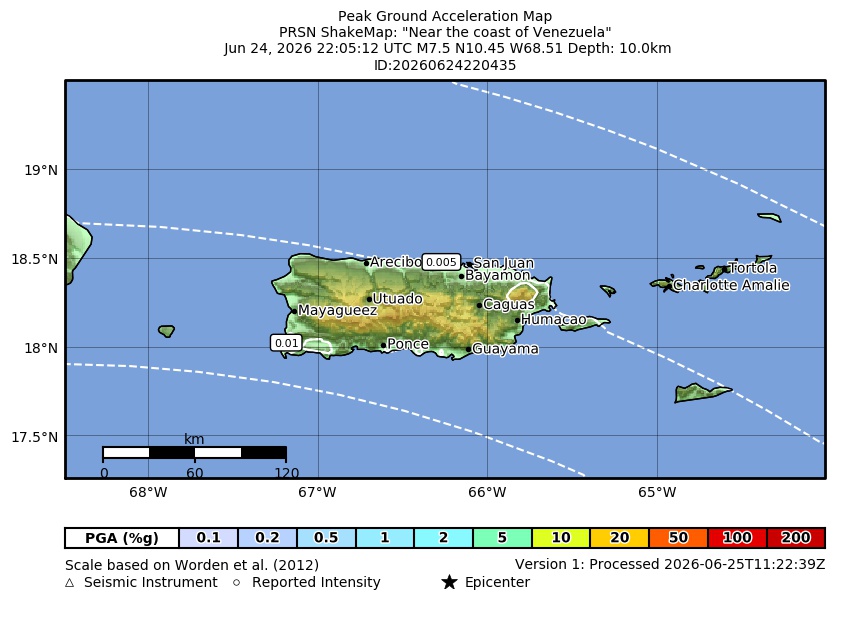 Peak Ground Acceleration |
 DYFI Map |
Google Map for this Event |